Weather:
- Ha Noi 26oC
- Da Nang 25oC
- Ho Chi Minh 26oC
Bồ Xuân Hiệp
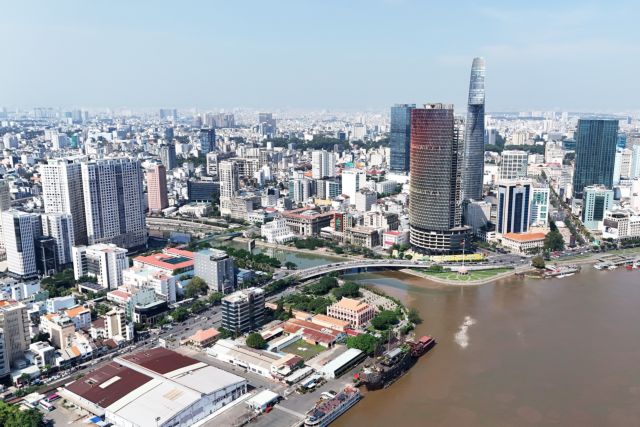
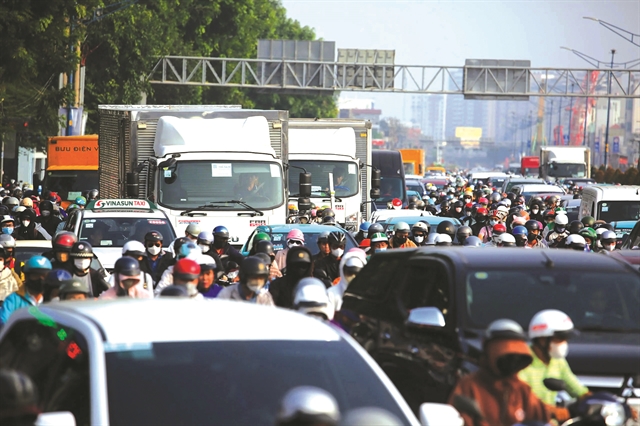
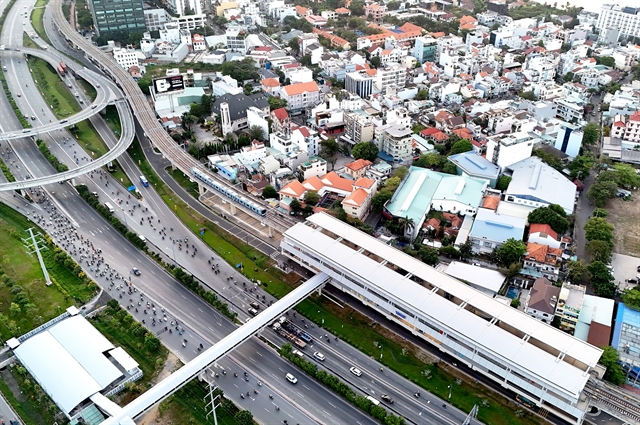
At rush hour, a journey to work or school can consume hours. Apartment towers continue to rise, while parks, roads and public spaces struggle to keep pace.
For Nguyễn Thúy Vân, 38, a resident of An Nhơn Ward, that is not an abstract planning problem.
Her family bought an apartment in 2018 because it was considered conveniently located between the airport and the city centre. Years later, getting her children to school and travelling to work can take her two to three hours a day.
“Actually, there are days when just going to school and work takes nearly half the morning,” she told Việt Nam News.
Her experience points to a question that HCM City is now trying to answer on a much larger scale: can a city become bigger and richer without becoming harder to live in?
The question is particularly important as HCM City looks towards 2075, with a 100-year vision that seeks to reshape the metropolis around new growth centres, transport corridors, riverfronts and ecological networks.
No one can know with certainty how technology, transport, climate or patterns of work and living will change over the next half-century.
But the city can decide today what kind of urban structure it wants to leave to future generations.
Following its expansion through the merger with the neighbouring provinces of Bình Dương and Bà Rịa-Vũng Tàu, HCM City, Việt Nam’s largest economic hub, is no longer simply a densely populated urban centre. It is becoming a vast metropolitan region encompassing industrial zones, ports, coastal areas, new urban centres and major ecological systems.
Its draft master plan for 2025-50, with a vision to 2075, proposes a spatial structure based on five growth poles, five strategic connectivity systems and 10 development-governance areas.
Behind the maps and economic targets, however, lies a more fundamental challenge: ensuring that today’s development does not become tomorrow's urban burden.
Beyond one centre
For much of its modern history, development has been concentrated around the traditional core.
That concentration helped make the city Việt Nam’s economic engine, bringing together businesses, jobs, universities, services and cultural institutions.
But it has also placed enormous pressure on infrastructure.
The existing inner urban area contains more than 1,500 apartment buildings, while many roads, schools, hospitals, parking facilities and parks were designed for an earlier population and a different pattern of development.
Land for transport infrastructure accounts for only around 15 per cent of urban land in the former HCM City area, below the planning target of 20-25 per cent. Green space is even more limited, at about 0.55 square metres per person.
“There are more buildings, more people and more cars, but the roads and public spaces have not grown with them,” said Lê Thị Thu Hương, 52, who sells breakfast food in an alley in Phú Nhuận Ward.
Transport expert Đoàn Hồng Đức of the University of Transport and Communications in HCM City said the problem was cumulative. “A road or school has to serve an entire area, not a single project,” he said.
When developments are approved separately, each might comply with planning and legal requirements, he said, but their combined impact could overwhelm surrounding infrastructure.
“Being in line with planning at the project level does not necessarily mean being right at the urban level,” he said.
The proposed answer is a shift from a single dominant centre towards a polycentric metropolis, where new growth poles attract jobs, investment, housing and services rather than simply adding residential developments on the outskirts.
For residents, its success will ultimately be measured in simpler terms: whether they can live closer to their workplaces, schools and essential services.
Reclaiming the river
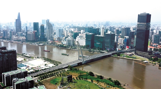
Few features offer a stronger organising element than the Sài Gòn River.
For more than three centuries, the river has shaped the city’s history, trade and identity. Now city planners and urban specialists want it to play an even greater role in its future.
Urban expert Nguyễn Thị Lệ has called for the river to become a strategic axis of the 100-year plan and proposed a separate master plan for it.
“The Sài Gòn River is a special urban asset of HCM City,” she said at a consultation on the draft master plan.
She proposed reserving at least 50 metres on each side of the river for public space and preventing commercial construction from taking over the waterfront.
The draft plan envisions the river as the city's principal landscape axis, cultural space, public realm and ecological corridor.
In time, parks, squares, pedestrian and cycling routes, cultural venues and water transport could connect areas from the north of the city through the central districts to Cần Giờ.
Nguyễn Thị Ánh Hoa, chairwoman of Saigontourist Group, said the river was a distinctive economic and cultural asset.
But she warned against allowing commercial development to dominate it.
“We cannot focus on developing large-scale entertainment complexes and forget public spaces along both sides of the river,” she said.
A global city, in other words, does not become globally attractive simply by putting expensive buildings beside a river.
Its waterfront must also remain a place where ordinary residents can walk, exercise, relax and experience their city.
At Bến Nhà Rồng-Khánh Hội, one of the city’s most historic riverfront areas, a major redevelopment project is planned to create a large public waterfront space, while Nguyễn Tất Thành Street is set to be expanded.
The project is being developed alongside the new administrative centre in Thủ Thiêm, with the two projects representing more than VNĐ50 trillion in investment.
The challenge will be to ensure these projects become part of a continuous riverfront system rather than isolated landmarks.
Living with water
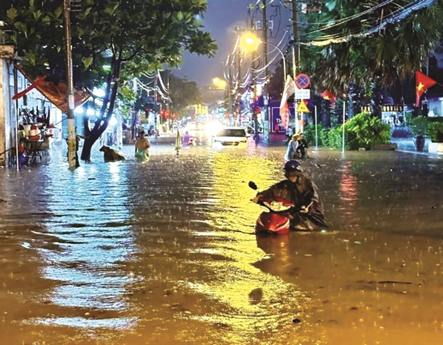
The river also points to a more difficult reality.
HCM City is a low-lying metropolis facing land subsidence, flooding, rising sea levels and climate change. Its future cannot therefore be planned simply around where land is available or where development is commercially attractive.
“We have learned to live with the water, but we don’t know what will happen in 20 or 30 years,” said Nguyễn Văn Thu, 67, a resident of Thảo Điền Ward.
Architect and urban planner Ngô Viết Nam Sơn said the 100-year plan must put residents' safety at its centre.
“The concept of putting people at the centre must be at the heart of the 100-year plan,” he said, warning that flooding and climate change could cause large-scale population displacement.
That makes long-term planning about more than roads and buildings.
Decisions about wetlands, drainage corridors, riverbanks and development density can determine the city’s vulnerability for generations.
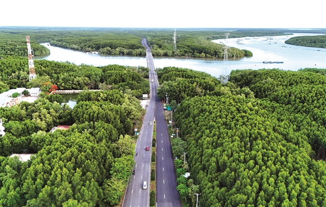
The enlarged HCM City includes Cần Giờ and the vast Rừng Sác mangrove ecosystem, as well as major river and canal networks. The draft plan places these natural systems within a broader “green-blue” ecological network.
Nature, in this vision, is no longer simply something to preserve outside the city.
It is part of the city's infrastructure.
Connecting the metropolis
The scale of the proposed transport network reflects the changing geography of HCM City.
In September, the city proposed studying two additional ring roads, No 4.5 and No 5, with a combined length of roughly 632-679km, depending on the route selected for Ring Road 5.
The proposed corridors would strengthen connections with Đồng Nai, Tây Ninh and Lâm Đồng and open new routes towards the southeastern region, Central Highlands and south-central coast.
The city is also targeting a much larger urban railway network, with around 200km of urban rail planned for completion in 2026–30.
But roads and railways alone cannot create a successful metropolis.
For a polycentric city to work, jobs, universities, hospitals, schools, cultural facilities, parks and commercial districts must grow alongside transport infrastructure.
Otherwise, HCM City could simply create a larger metropolitan footprint while leaving the old centre’s gravitational pull unchanged.
Building for people
This may be the hardest test of the 100-year vision.
Master plans are often judged by maps: roads completed, buildings constructed, investment attracted and new districts established.
Residents experience a city differently.
They judge it by how long it takes to get to work, whether their children have a nearby school, whether there is a park within walking distance, whether their homes flood and whether they can afford to live near jobs and essential services.
For Vân, the future of HCM City is ultimately about those ordinary things: getting to work without spending hours in traffic, having schools and parks close to home and being able to move around without depending entirely on a motorbike.
Those expectations may sound modest compared with a vision stretching to 2075.
But they are precisely what will determine whether that vision succeeds.
No planner can know what HCM City will look like in 2075. Technology will change. Work will change. The climate will change. The population will age. New forms of transport and energy will emerge.
A 100-year plan cannot predict all of that.
It can, however, establish the principles by which the city adapts.
It can decide that the river belongs to the public; that housing should follow infrastructure rather than outrun it; that wetlands and green corridors are essential urban assets; and that growth should be distributed among multiple centres rather than endlessly concentrated in one.
It can also make climate resilience a basic condition of development rather than a problem to be addressed later.
HCM City has set itself an extraordinary ambition: to become a global city by 2075.
The harder task is deciding what must be protected, what must change and what must never be lost along the way.
For Vân and millions of others, the answer may ultimately be found not on a master-plan map, but in the everyday experience of living in the city.
And somewhere beyond today’s traffic, towers and construction sites, another generation is waiting to inherit the city being built now. — VNS
